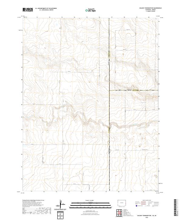
2022 Map of Colony Township NW
USGS Topo · Published 2022About this map
The high plains borderland between Colorado and Kansas is defined here by the winding course of S Ladder Cr, which cuts through the arid landscape of Colony Township. This survey illustrates a sparsely populated agricultural and ranching environment where the state line and county boundaries for Cheyenne, Wallace, and Greeley intersect. The land is organized by a strictly defined grid of rural routes, including descriptively named paths like Dusty Rd and Bumpy Rd, alongside more established thoroughfares like Arrowhead Rd and Thirteen Mile Rd. These roads provide the primary infrastructure for the scattered homesteads and farming operations that characterize this region of the Great Plains, where natural water sources like S Ladder Cr remain the central geographic features in an otherwise surveyed and sectioned territory.
Find a feature on this map
35 named features on this map. Tap any name to fly to it.
Don’t see what you’re looking for? This feature index may not catch every label — zoom into the map to look around manually.
Map Details
Editions of this 2022 Colony Township NW Map
This is the sole edition of this map. No revisions or reprints were ever made.
Other maps of this area

1892 · Cheyenne Wells
USGS Topo · 1:125,000

1894 · Cheyenne Wells
USGS Topo · 1:125,000

1954 · Lamar
USGS Topo · 1:250,000

1955 · Scott City
USGS Topo · 1:250,000

1958 · Lamar
USGS Topo · 1:250,000

1958 · Scott City
USGS Topo · 1:250,000

1959 · Weskan
USGS Topo · 1:62,500

1968 · Sharon Springs 3 NW
USGS Topo · 1:24,000

1969 · Arapahoe SE
USGS Topo · 1:24,000

1969 · Cheyenne Wells 4 NE
USGS Topo · 1:24,000