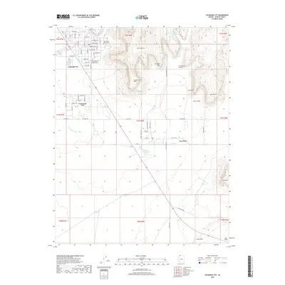
2018 Map of Colorado City
USGS Topo · Published 2018About this map
Colorado City and the nearby community of Centennial Park anchor the northwestern portion of this Arizona landscape, characterized by a grid of residential streets including Academy Ave and Edson Ave. The presence of the Mohave Community College North Mohave Campus and Isaac Carling Memorial Park reflects the established community infrastructure at the edge of the high desert. To the east, the terrain rises sharply toward the Vermilion Cliffs, where the plateau is deeply dissected by Skunk Canyon and Cottonwood Canyon. South of the cliffs, the small settlement of Cane Beds sits along the roadway system, surrounded by open rangeland dotted with features like Formaster Tank. The winding course of Cottonwood Wash traverses the southern half of the map, cutting through Pipe Valley near Cedar Ridge as the landscape transitions toward Lone Butte.
Find a feature on this map
74 named features on this map. Tap any name to fly to it.
Don’t see what you’re looking for? This feature index may not catch every label — zoom into the map to look around manually.
Map Details
Editions of this 2018 Colorado City Map
This is the sole edition of this map. No revisions or reprints were ever made.
Other maps of this area

1885 · St. George
USGS Topo · 1:250,000

1886 · Kanab
USGS Topo · 1:250,000

1886 · Mt. Trumbull
USGS Topo · 1:250,000

1886 · Kaibab
USGS Topo · 1:250,000

1891 · St. George
USGS Topo · 1:250,000

1892 · Mt. Trumbull
USGS Topo · 1:250,000

1953 · Cedar City
USGS Topo · 1:250,000

1953 · Grand Canyon
USGS Topo · 1:250,000

1954 · La Verkin 4 SE
USGS Topo · 1:24,000

1954 · Lost Spring SE
USGS Topo · 1:24,000