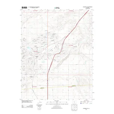
2013 Map of Colorado City
USGS Topo · Published 2013About this map
Colorado City and the neighboring settlement of Greenhorn define this high-plains landscape in southern Colorado, where residential street grids transition into a complex network of named arroyos and creeks. The hydrology of the region is central to its development, anchored by the Beckwith Reservoir to the west and Bonnie Meade Reservoir near the center of the community. A series of natural watercourses, including Greenhorn Cr, Little Graneros Cr, and the deep Graneros Gorge, drain the terrain toward the east. The map reveals an intricate street plan with names referencing local geography and regional history, such as Cuerno Verde Blvd and Bent Brothers Blvd. To the north, the landscape becomes more sparsely developed, marked by features like Scroggs Arroyo and the Crow Cutoff, illustrating the transition from planned community to open range near the Pueblo and Huerfano County line.
Find a feature on this map
124 named features on this map. Tap any name to fly to it.
Don’t see what you’re looking for? This feature index may not catch every label — zoom into the map to look around manually.
Map Details
Editions of this 2013 Colorado City Map
This is the sole edition of this map. No revisions or reprints were ever made.
Other maps of this area

1891 · Walsenburg
USGS Topo · 1:125,000

1891 · Pueblo
USGS Topo · 1:125,000

1894 · Walsenburg
USGS Topo · 1:125,000

1894 · Pueblo
USGS Topo · 1:125,000

1896 · Pueblo
USGS Topo · 1:125,000

1897 · Pueblo
USGS Topo · 1:125,000

1897 · Walsenburg
USGS Topo · 1:125,000

1900 · Walsenburg
USGS Topo · 1:125,000

1954 · Trinidad
USGS Topo · 1:250,000

1954 · Pueblo
USGS Topo · 1:250,000