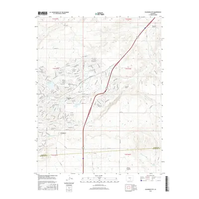
2016 Map of Colorado City
USGS Topo · Published 2016About this map
Colorado City and Greenhorn sit at the western edge of the plains where the high desert begins its ascent toward the mountains. This 2016 survey documents the residential development and water infrastructure of the area, notably the Beckwith Reservoir and Bonnie Meade Reservoir. The landscape is defined by the sharp incisions of local drainages like Scroggs Arroyo and the prominent Graneros Gorge, which cuts through the terrain east of the Interstate 25 corridor. A touch of local history is preserved at the Hicklin Family Cem, located near the intersection of several county roads. The map also captures the importance of regional aviation with The Flying Z Airport and Diamond Star Ranch Airport positioned on the outskirts of the settlement. The boundary between Pueblo Co and Huerfano Co is clearly delineated across the southern portion of the quadrangle.
Find a feature on this map
177 named features on this map. Tap any name to fly to it.
Don’t see what you’re looking for? This feature index may not catch every label — zoom into the map to look around manually.
Map Details
Editions of this 2016 Colorado City Map
This is the sole edition of this map. No revisions or reprints were ever made.
Other maps of this area

1891 · Walsenburg
USGS Topo · 1:125,000

1891 · Pueblo
USGS Topo · 1:125,000

1894 · Walsenburg
USGS Topo · 1:125,000

1894 · Pueblo
USGS Topo · 1:125,000

1896 · Pueblo
USGS Topo · 1:125,000

1897 · Pueblo
USGS Topo · 1:125,000

1897 · Walsenburg
USGS Topo · 1:125,000

1900 · Walsenburg
USGS Topo · 1:125,000

1954 · Trinidad
USGS Topo · 1:250,000

1954 · Pueblo
USGS Topo · 1:250,000