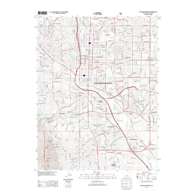
2013 Map of Colorado Springs
USGS Topo · Published 2013About this map
Colorado Springs is captured here during a period of significant suburban expansion, where established urban neighborhoods meet the rising slopes of Cheyenne Mountain. The map details the transition from the city's academic and religious core, including Colorado Coll and several prominent columbariums like Grace and Saint Stephen's Episcopal Church Columbarium, to the military and industrial landscapes of the south. Landmarks such as the Cheyenne Mountain Zoo and the Will Rogers Shrine of the Sun Cem stand as prominent features on the western edge, overlooking the developing communities of Broadmoor and Ivywild.
Find a feature on this map
107 named features on this map. Tap any name to fly to it.
Don’t see what you’re looking for? This feature index may not catch every label — zoom into the map to look around manually.
Map Details
Editions of this 2013 Colorado Springs Map
This is the sole edition of this map. No revisions or reprints were ever made.
Other maps of this area

1893 · Colorado Springs
USGS Topo · 1:125,000

1909 · Colorado Springs
USGS Topo · 1:125,000

1942 · Colorado Springs
USGS Topo · 1:125,000

1948 · Mount Big Chief
USGS Topo · 1:24,000

1948 · Manitou Springs
USGS Topo · 1:24,000

1948 · Colorado Springs
USGS Topo · 1:62,500

1948 · Pikeview
USGS Topo · 1:24,000

1948 · Cascade
USGS Topo · 1:24,000

1948 · Fountain
USGS Topo · 1:24,000

1948 · Colorado Springs
USGS Topo · 1:24,000
Featured Places
- Colorado Springs, CO
- Security-Widefield, CO
- Stratton Meadows, Colorado Springs
- Broadmoor, Colorado Springs
- Kelker, Colorado Springs