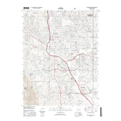
2016 Map of Colorado Springs
USGS Topo · Published 2016About this map
Cheyenne Mountain dominates the southwestern horizon, marking the edge of the Pike National Forest where it meets the urban sprawl of El Paso County. This detailed study documents the transition from the city's residential neighborhoods like Knob Hill and Stratton Meadows into the steep canyons of North Cheyenne Canyon and South Cheyenne Canyon. The landscape is notably defined by its many columbaria and cemeteries, including the Will Rogers Shrine of the Sun and the historic Evergreen Cemetery, reflecting the city's long-standing role as a center for reflection and rest.
Find a feature on this map
79 named features on this map. Tap any name to fly to it.
Don’t see what you’re looking for? This feature index may not catch every label — zoom into the map to look around manually.
Map Details
Editions of this 2016 Colorado Springs Map
This is the sole edition of this map. No revisions or reprints were ever made.
Other maps of this area

1893 · Colorado Springs
USGS Topo · 1:125,000

1909 · Colorado Springs
USGS Topo · 1:125,000

1942 · Colorado Springs
USGS Topo · 1:125,000

1948 · Mount Big Chief
USGS Topo · 1:24,000

1948 · Manitou Springs
USGS Topo · 1:24,000

1948 · Colorado Springs
USGS Topo · 1:62,500

1948 · Pikeview
USGS Topo · 1:24,000

1948 · Cascade
USGS Topo · 1:24,000

1948 · Fountain
USGS Topo · 1:24,000

1948 · Colorado Springs
USGS Topo · 1:24,000
Featured Places
- Colorado Springs, CO
- Security-Widefield, CO
- Stratton Meadows, Colorado Springs
- Broadmoor, Colorado Springs
- Kelker, Colorado Springs