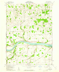
1960 Map of Colton
USGS Topo · Published 1961About this map
The Maumee River serves as the central artery for this 1960 landscape, carving through the townships of Washington, Damascus, and Grand Rapids. The river's influence is evident in the placement of the Grand Rapids Dam and the nearby Thurston State Park, while a network of drainage channels like Aumend Ditch and Krohn Ditch speak to the agricultural history of the surrounding flatlands.
Find a feature on this map
53 named features on this map. Tap any name to fly to it.
Don’t see what you’re looking for? This feature index may not catch every label — zoom into the map to look around manually.
Map Details
Editions of this 1960 Colton Map
3 editions found
Other maps of this area

1908 · Napoleon
USGS Topo · 1:62,500

1909 · Mc Clure
USGS Topo · 1:62,500

1911 · Wauseon
USGS Topo · 1:62,500

1911 · Swanton
USGS Topo · 1:62,500

1913 · Wauseon
USGS Topo · 1:62,500

1914 · Swanton
USGS Topo · 1:62,500

1935 · Grand Rapids
USGS Topo · 1:24,000

1935 · Whitehouse
USGS Topo · 1:24,000
1940 · Whitehouse
USGS Topo · 1:31,680

1940 · Grand Rapids
USGS Topo · 1:31,680