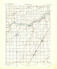
1909 Map of Mc Clure
USGS Topo · Published 1936About this map
The Maumee River serves as the dominant landscape feature of this 1909 survey, carving a path through Henry, Lucas, and Wood Counties. Along its banks, the historic remnants of the Wabash and Erie Canal and the Miami and Erie Canal are clearly visible, tracing the older transportation routes that once fueled the region's growth. The survey documents a transition from water-based commerce to a dense network of early 20th-century rail, including the Toledo Electric RR and the Wabash RR.
Find a feature on this map
53 named features on this map. Tap any name to fly to it.
Don’t see what you’re looking for? This feature index may not catch every label — zoom into the map to look around manually.
Map Details
Editions of this 1909 Mc Clure Map
2 editions found
Other maps of this area

1900 · Toledo
USGS Topo · 1:62,500

1901 · Bowling Green
USGS Topo · 1:62,500

1903 · Bowling Green
USGS Topo · 1:62,500

1903 · Findlay
USGS Topo · 1:62,500

1908 · Ottawa
USGS Topo · 1:62,500

1908 · Napoleon
USGS Topo · 1:62,500

1909 · Mc Clure
USGS Topo · 1:62,500

1911 · Wauseon
USGS Topo · 1:62,500

1911 · Swanton
USGS Topo · 1:62,500

1913 · Wauseon
USGS Topo · 1:62,500