
Historical Maps of Lucas County, Ohio
What stories do these 136 old maps tell about Lucas County's past? From 1900 to present day, these maps reveal the evolution of streets, neighborhoods, iconic landmarks, and natural features in stunning high-res detail. Whether you're a history enthusiast, genealogist, or professional in education, environmental work, or architecture, these maps are perfect for exploration, research, and discovery.
Discover Lucas County's history through maps:
- Trace Lucas County's growth: Explore earlier and latest maps and editions to uncover how the region changed over time.
- Examine technical details: Each map includes its creators, publishers, scale, dimensions, and full source information.
- Layer maps with modern tools & imagery: Compare historical maps to modern-day with high-resolution satellite imagery and detailed LiDAR layers.
- Sourced from trusted archives: Carefully preserved and digitized by institutions like the United Stated Geological Survey and the US Library of Congress.
- Access in any format: View and explore in high resolution, download for offline use, or order a museum-quality print for yourself or a loved one.
Begin your journey into Lucas County's history with these remarkable must-see maps.
Lucas County, OH maps
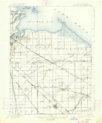
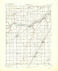
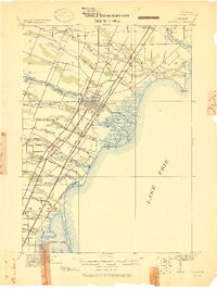
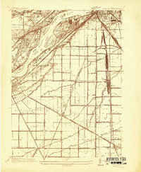
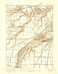
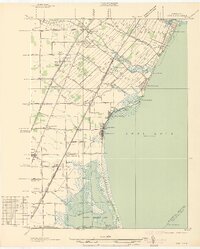
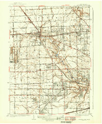
(136)- 1900 Map of Maumee Bay, 1921 Print
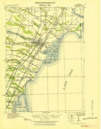
 1900 Maumee Bay1921 Print · USGSCovers Lucas County, including Toledo, Oregon, and other nearby areas
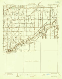
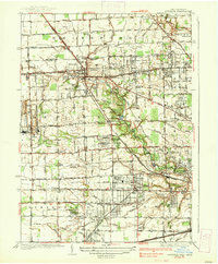
 - 1900 Map of Toledo, 1932 Print
 1900 Toledo1932 Print · USGSCovers Lucas County, including Toledo, Bedford Township, and other nearby areas
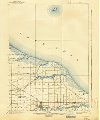
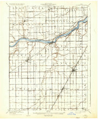
 - 1900 Map of Maumee Bay, 1934 Print
 1900 Maumee Bay1934 Print · USGSCovers Lucas County, including Toledo, Oregon, and other nearby areas
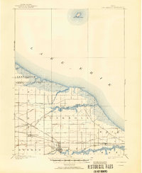
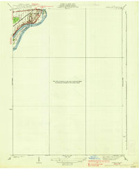
 - 1900 Map of Oak Harbor, 1943 Print
 1900 Oak Harbor1943 Print · USGSCovers Lucas County, including Oak Harbor, Rocky Ridge, and other nearby areas
 - 1900 Map of Oak Harbor, 1950 Print
 1900 Oak Harbor1950 Print · USGSCovers Lucas County, including Oak Harbor, Rocky Ridge, and other nearby areas
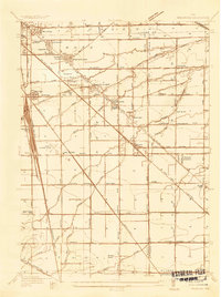
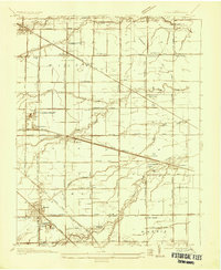
 - 1901 Map of Bowling Green, 1958 Print
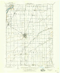 1901 Bowling Green1958 Print · USGSCovers Lucas County, including Bowling Green, Perrysburg, and other nearby areas
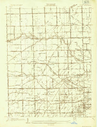
 - 1909 Map of Mc Clure, 1936 Print
 1909 Mc Clure1936 Print · USGSCovers Lucas County, including Waterville, Providence, and other nearby areas
 - 1909 Map of Mc Clure, 1936 Print
 1909 Mc Clure1936 Print · USGSCovers Lucas County, including Waterville, Providence, and other nearby areas
 - 1911 Map of Swanton, 1956 Print
 1911 Swanton1956 Print · USGSCovers Lucas County, including Waterville, Whiteford Township, and other nearby areas
 - 1912 Map of Monroe
 1912 Monroe1912 Print · USGSCovers Lucas County, including Frenchtown Charter Township, Monroe, and other nearby areas
 - 1914 Map of Monroe, 1928 Print
 1914 Monroe1928 Print · USGSCovers Lucas County, including Frenchtown Charter Township, Monroe, and other nearby areas
 - 1914 Map of Swanton, 1937 Print
 1914 Swanton1937 Print · USGSCovers Lucas County, including Waterville, Whiteford Township, and other nearby areas
 - 1934 Map of Reno Beach
 1934 Reno Beach1934 Print · USGSCovers Lucas County, including Oregon, Yondota, and other nearby areas
 - 1934 Map of Point Place
 1934 Point Place1934 Print · USGSCovers Lucas County, including Toledo, Oregon, and other nearby areas
 - 1934 Map of Rossford
 1934 Rossford1934 Print · USGSCovers Lucas County, including Toledo, Perrysburg, and other nearby areas
 - 1935 Map of Walbridge
 1935 Walbridge1935 Print · USGSCovers Lucas County, including Oregon, Northwood, and other nearby areas
 - 1935 Map of Grand Rapids
 1935 Grand Rapids1935 Print · USGSCovers Lucas County, including Waterville, Providence, and other nearby areas
 - 1935 Map of Whitehouse
 1935 Whitehouse1935 Print · USGSCovers Lucas County, including Waterville, Swanton, and other nearby areas
 - 1935 Map of Maumee
 1935 Maumee1935 Print · USGSCovers Lucas County, including Toledo, Perrysburg, and other nearby areas
 - 1935 Map of Genoa
 1935 Genoa1935 Print · USGSCovers Lucas County, including Genoa, Clay Center, and other nearby areas
 - 1935 Map of Berkey
 1935 Berkey1935 Print · USGSCovers Lucas County, including Whiteford Township, Berkey, and other nearby areas
 - 1936 Map of Erie
 1936 Erie1936 Print · USGSCovers Lucas County, including Monroe Charter Township, LaSalle, and other nearby areas
 - 1937 Map of Sylvania
 1937 Sylvania1937 Print · USGSCovers Lucas County, including Toledo, Bedford Township, and other nearby areas
 - 1937 Map of Sylvania
 1937 Sylvania1937 Print · USGSCovers Lucas County, including Toledo, Bedford Township, and other nearby areas
 - 1938 Map of Tontogany
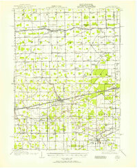
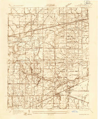
 1938 Tontogany1938 Print · USGSCovers Lucas County, including Bowling Green, Perrysburg, and other nearby areas
Showing maps 1-25 of 136
Top cities in Lucas County
- Toledo historical maps
- Oregon historical maps
- Sylvania historical maps
- Maumee historical maps
- Monclova historical maps
- Waterville historical maps
See more
Frequently asked questions
- What are the different types of historical maps available for Lucas County?
- What is the oldest map of Lucas County?
- Where can I purchase historical maps of Lucas County for my home or office?
- Where can I download high-res historical maps of Lucas County?
- Are there historical topographic maps available for Lucas County?
- Is there historical aerial imagery available for Lucas County?
- Where are historical maps of Lucas County sourced from?