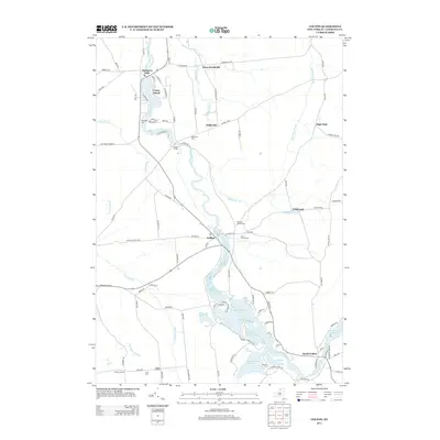
2013 Map of Colton
USGS Topo · Published 2013About this map
Raquette River dictates the landscape of this Saint Lawrence County survey, flowing north through a series of significant water impoundments and falls. The settlement of Colton serves as a central hub, flanked by the river's wider reaches at Warm Brook Flow and the South Colton Reservoir to the south. Further downstream, the river passes Coney Island at Hannawa Falls, where the terrain begins to transition into the more grid-like agricultural road patterns of the north.
Find a feature on this map
103 named features on this map. Tap any name to fly to it.
Don’t see what you’re looking for? This feature index may not catch every label — zoom into the map to look around manually.
Map Details
Editions of this 2013 Colton Map
This is the sole edition of this map. No revisions or reprints were ever made.
Other maps of this area

1908 · Potsdam
USGS Topo · 1:62,500

1910 · Canton
USGS Topo · 1:62,500

1911 · Canton
USGS Topo · 1:62,500

1915 · Russell
USGS Topo · 1:62,500

1918 · Russell
USGS Topo · 1:62,500

1921 · Stark
USGS Topo · 1:62,500

1923 · Stark
USGS Topo · 1:62,500

1940 · Stark
USGS Topo · 1:62,500

1942 · Long Bow
USGS Topo · 1:24,000

1943 · Potsdam
USGS Topo · 1:31,680