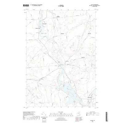
2019 Map of Colton
USGS Topo · Published 2019About this map
The Raquette River dominates the landscape of Saint Lawrence County, winding north through the settlements of South Colton, Colton, and Hannawa Falls. This 2019 survey documents the river's significant hydraulic role, showing the Warm Brook Flow and the drop at Higley Falls. The map reveals a high concentration of burial grounds necessary for genealogical research, including Riverside Cem near the riverbanks and the more interior Saint Patrick Cem. Small hamlets like West Parishville, Willisville, and High Flats appear along the secondary road network, connected by routes such as Pumpkin Hill Rd and Butternut Ridge Rd. The terrain is defined by a series of brooks, such as Stafford Brook and O'Malley Brook, which feed the main river corridor through this forested region of Northern New York.
Find a feature on this map
113 named features on this map. Tap any name to fly to it.
Don’t see what you’re looking for? This feature index may not catch every label — zoom into the map to look around manually.
Map Details
Editions of this 2019 Colton Map
This is the sole edition of this map. No revisions or reprints were ever made.
Other maps of this area

1908 · Potsdam
USGS Topo · 1:62,500

1910 · Canton
USGS Topo · 1:62,500

1911 · Canton
USGS Topo · 1:62,500

1915 · Russell
USGS Topo · 1:62,500

1918 · Russell
USGS Topo · 1:62,500

1921 · Stark
USGS Topo · 1:62,500

1923 · Stark
USGS Topo · 1:62,500

1940 · Stark
USGS Topo · 1:62,500

1942 · Long Bow
USGS Topo · 1:24,000

1943 · Potsdam
USGS Topo · 1:31,680