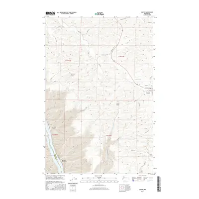
2017 Map of Colton
USGS Topo · Published 2017About this map
The town of Colton serves as the primary hub in this portion of the Palouse, situated where Union Flat Cr winds through the eastern agricultural landscape. The terrain is defined by deep, winding drainage systems that cut through the plateau, including Yakawawa Canyon, Steptoe Canyon, and Stuart Canyon. To the southwest, the landscape drops sharply toward the Snake River, which forms the boundary between Whitman Co and Garfield Co. This reach of the river includes the waters of Lower Granite Lake, an impoundment that altered the original riverbank geography. Smaller watercourses like Steptoe Cr and numerous named rural routes, such as Rimrock Rd and Wawawai Rd, provide a detailed look at the rural infrastructure and land management patterns of the early 21st century.
Find a feature on this map
33 named features on this map. Tap any name to fly to it.
Don’t see what you’re looking for? This feature index may not catch every label — zoom into the map to look around manually.
Map Details
Editions of this 2017 Colton Map
This is the sole edition of this map. No revisions or reprints were ever made.
Other maps of this area

1910 · Pullman
USGS Topo · 1:125,000

1943 · Peola
USGS Topo · 1:62,500

1945 · Clarkston
USGS Topo · 1:62,500

1946 · Peola
USGS Topo · 1:62,500

1948 · Clarkston
USGS Topo · 1:62,500

1955 · Pullman
USGS Topo · 1:250,000

1958 · Pullman
USGS Topo · 1:250,000

1964 · Moscow West
USGS Topo · 1:24,000

1964 · Colton
USGS Topo · 1:24,000

1964 · Ewartsville
USGS Topo · 1:24,000