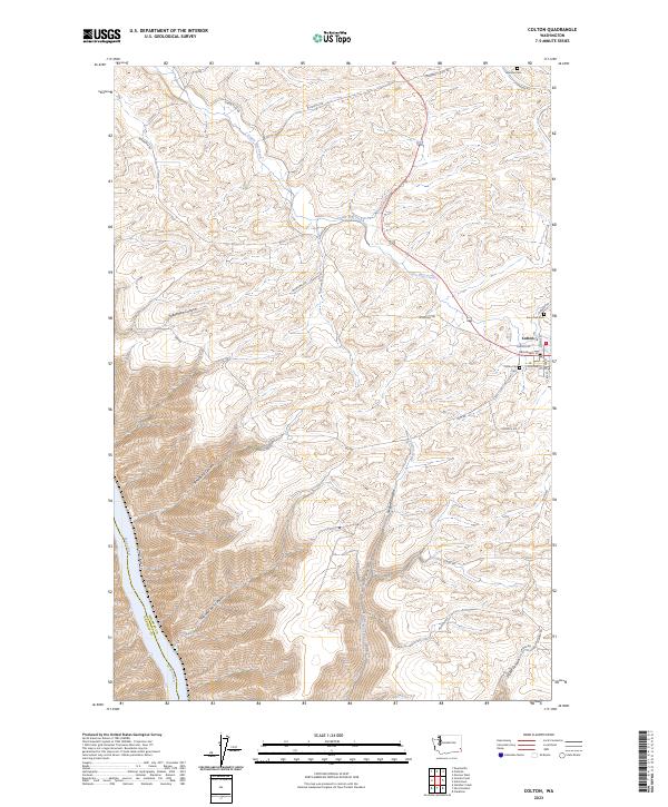
2023 Map of Colton
USGS Topo · Published 2023About this map
Colton serves as the primary settlement hub on this plateau above the Snake River, where the town's street grid, including Broadway St and Steptoe St, meets the surrounding agricultural landscape. The region is defined by deep, winding drainages that cut through the high country toward the river valley, most notably Yakawawa Canyon, Steptoe Canyon, and Nisqually John Canyon. These natural features dictate the winding paths of local roads like Wawawai Rd and Rim Rd as they navigate the breaks.
Find a feature on this map
31 named features on this map. Tap any name to fly to it.
Don’t see what you’re looking for? This feature index may not catch every label — zoom into the map to look around manually.
Map Details
Editions of this 2023 Colton Map
This is the sole edition of this map. No revisions or reprints were ever made.
Other maps of this area

1910 · Pullman
USGS Topo · 1:125,000

1943 · Peola
USGS Topo · 1:62,500

1945 · Clarkston
USGS Topo · 1:62,500

1946 · Peola
USGS Topo · 1:62,500

1948 · Clarkston
USGS Topo · 1:62,500

1955 · Pullman
USGS Topo · 1:250,000

1958 · Pullman
USGS Topo · 1:250,000

1964 · Moscow West
USGS Topo · 1:24,000

1964 · Colton
USGS Topo · 1:24,000

1964 · Ewartsville
USGS Topo · 1:24,000