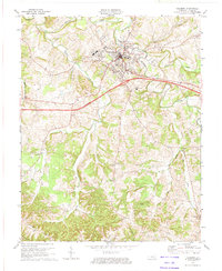
1973 Map of Columbia
USGS Topo · Published 1974About this map
Columbia serves as the focal point of this 1970s survey, centered on the campus of Lindsey Wilson College and the winding course of Russell Creek. The landscape reflects a mix of traditional agricultural patterns and modern infrastructure, notably the path of the Cumberland Parkway Toll Road cutting across the central hills. Rural life is well-documented through numerous family and community landmarks, from the Santa Fee Ch in the west to the small settlements of Fairplay and Gadberry in the south. The southern reaches of the map are defined by a network of ridges and hollows, including Burton Ridge and Earl Ridge, while numerous oil wells scattered near Flatwood suggest the era's local extractive industry. Genealogists can find significant detail in the placement of the New Columbia Cem and several smaller church-adjacent burial grounds that anchor these crossroads communities.
Find a feature on this map
43 named features on this map. Tap any name to fly to it.
Don’t see what you’re looking for? This feature index may not catch every label — zoom into the map to look around manually.
Map Details
Editions of this 1973 Columbia Map
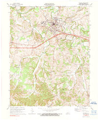
2 editions found
Other maps of this area

1953 · Gradyville
USGS Topo · 1:24,000

1953 · Breeding
USGS Topo · 1:24,000

1953 · Amandaville
USGS Topo · 1:24,000

1953 · Montpelier
USGS Topo · 1:24,000

1953 · Gresham
USGS Topo · 1:24,000

1953 · Creelsboro
USGS Topo · 1:24,000

1953 · Cane Valley
USGS Topo · 1:24,000

1954 · Knifley
USGS Topo · 1:24,000

1954 · Columbia
USGS Topo · 1:24,000

1956 · Corbin
USGS Topo · 1:250,000