
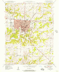
1935 Map of Columbia
USGS Topo · Published 1935About this map
Columbia serves as a thriving educational and transit hub in the mid-1930s, defined by its concentration of academic institutions and early aviation infrastructure. The campus of the University of Missouri dominates the southern part of the city, adjacent to Memorial Stadium and Rollins Field, while Stephens Col and Christian College anchor the central district. The Wabash RR terminates in the heart of town, providing a critical rail link for the region's agricultural and collegiate needs.
Find a feature on this map
49 named features on this map. Tap any name to fly to it.
Don’t see what you’re looking for? This feature index may not catch every label — zoom into the map to look around manually.
Map Details
Editions of this 1935 Columbia Map
This is the sole edition of this map. No revisions or reprints were ever made.
Other maps of this area

1886 · Jefferson City
USGS Topo · 1:125,000

1890 · Moberly
USGS Topo · 1:125,000

1894 · Jefferson City
USGS Topo · 1:125,000

1917 · Sturgeon
USGS Topo · 1:62,500

1940 · Columbia
USGS Topo · 1:24,000

1944 · Millersburg
USGS Topo · 1:62,500

1945 · Centralia
USGS Topo · 1:62,500

1946 · Millersburg
USGS Topo · 1:62,500

1947 · Jefferson City
USGS Topo · 1:250,000
1948 · Columbia
USGS Topo · 1:24,000