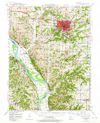
1948 Map of Columbia
USGS Topo · Published 1964About this map
Columbia serves as the focal point of this late 1940s landscape, featuring prominent landmarks such as Memorial Stadium, Rollins Field, and the Municipal Airport. The urban core is surrounded by an extensive network of rural schools and churches, reflecting a mid-century educational and social structure rooted in the countryside. To the south and west, the Missouri River winds along the Boone County border, flanked by a complex system of levees and rail infrastructure, including the Wabash RR and the Missouri Kansas Texas line.
Find a feature on this map
80 named features on this map. Tap any name to fly to it.
Don’t see what you’re looking for? This feature index may not catch every label — zoom into the map to look around manually.
Map Details
Editions of this 1948 Columbia Map
2 editions found

Other maps of this area

1886 · Jefferson City
USGS Topo · 1:125,000

1888 · Boonville
USGS Topo · 1:125,000

1890 · Moberly
USGS Topo · 1:125,000

1890 · Glasgow
USGS Topo · 1:125,000

1894 · Jefferson City
USGS Topo · 1:125,000

1917 · Sturgeon
USGS Topo · 1:62,500

1935 · Columbia
USGS Topo · 1:24,000

1939 · Jefferson City
USGS Topo · 1:62,500

1940 · Columbia
USGS Topo · 1:24,000

1942 · Jefferson City
USGS Topo · 1:62,500