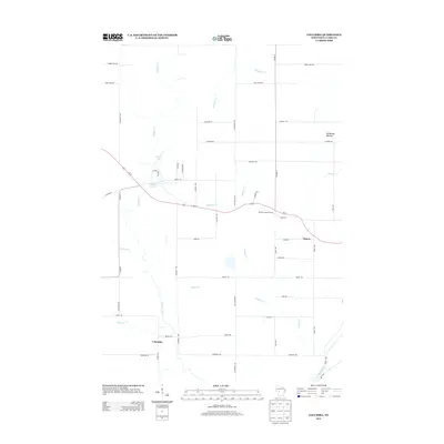
2013 Map of Columbia
USGS Topo · Published 2013About this map
Columbia and the nearby settlement of Sidney anchor this 2013 survey of Clark County, defined by a network of rural roads and numerous waterways. The landscape is marked by the presence of the Neillsville Mounds in the northeast and the Moraine Lookout Tower situated along Us-10, which serves as the primary east-west corridor through the region. Significant water features including Wedges Cr, Meadows Cr, and Conlan Cr drain the territory, eventually reaching the Black River in the southeast corner. Local recreation and geography are highlighted at Snyder Lake, where residential roads like Witte Ave and Arndt Rd intersect near the water. The map provides a detailed view of family-named thoroughfares and small-town footprints such as Snyder Lake 46 at a time of established rural infrastructure.
Find a feature on this map
46 named features on this map. Tap any name to fly to it.
Don’t see what you’re looking for? This feature index may not catch every label — zoom into the map to look around manually.
Map Details
Editions of this 2013 Columbia Map
This is the sole edition of this map. No revisions or reprints were ever made.
Other maps of this area

1924 · Black River Falls
USGS Topo · 1:62,500

1926 · Black River Falls
USGS Topo · 1:62,500

1948 · Fairchild
USGS Topo · 1:62,500

1949 · Fairchild
USGS Topo · 1:62,500

1953 · Neillsville
USGS Topo · 1:62,500

1953 · Eau Claire
USGS Topo · 1:250,000

1958 · Eau Claire
USGS Topo · 1:250,000

1958 · Hatfield
USGS Topo · 1:48,000

1964 · Eau Claire
USGS Topo · 1:250,000
1968 · Black River Falls
USGS Topo · 1:62,500