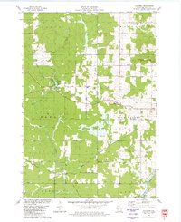
1979 Map of Columbia
USGS Topo · Published 1980About this map
The Chicago and North Western rail corridor and an abandoned Old Railroad Grade define the logistical history of this Clark County landscape. Settled pockets like Columbia and Sidney appear alongside evidence of early community life, including the Zion Ch and the Columbia Cem. The terrain is marked by the Neillsville Mounds in the northeast and the course of the Black River in the southeast. Significant land use is noted through the Moraine Lookout Tower and multiple recreational spaces such as Snyder County Park and Wayside Park. Numerous family-named roads, including Marden Lane and Schulz Lane, provide a granular look at rural property divisions and historical residency patterns in the late 1970s.
Find a feature on this map
47 named features on this map. Tap any name to fly to it.
Don’t see what you’re looking for? This feature index may not catch every label — zoom into the map to look around manually.
Map Details
Editions of this 1979 Columbia Map
This is the sole edition of this map. No revisions or reprints were ever made.
Other maps of this area

1924 · Black River Falls
USGS Topo · 1:62,500

1926 · Black River Falls
USGS Topo · 1:62,500

1948 · Fairchild
USGS Topo · 1:62,500

1949 · Fairchild
USGS Topo · 1:62,500

1953 · Neillsville
USGS Topo · 1:62,500

1953 · Eau Claire
USGS Topo · 1:250,000

1958 · Eau Claire
USGS Topo · 1:250,000

1958 · Hatfield
USGS Topo · 1:48,000

1964 · Eau Claire
USGS Topo · 1:250,000
1968 · Black River Falls
USGS Topo · 1:62,500