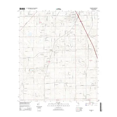
2015 Map of Columbia
USGS Topo · Published 2015About this map
Bass and the surrounding rural corridors of Columbia County are defined by a complex grid of residential roads and small family cemeteries in this 2015 survey. The landscape is primarily inland and well-drained, marked by intermittent watercourses like Clay Hole Cr and Rose Cr. Local history is anchored by several burial grounds, including Athens Cem, Columbia Community Cem, and Pleasant Grove Cem, which serve as key landmarks for genealogists tracing regional family ties. The northern portion of the map features the Delta Airport, while a dense network of residential thoroughfares such as SW Sisters Welcome Rd and SW Tustenuggee Ave shows the modern subdivision of traditional Florida lands. This transition from open acreage to named residential clusters reflects the ongoing development of the area south of Lake City.
Find a feature on this map
130 named features on this map. Tap any name to fly to it.
Don’t see what you’re looking for? This feature index may not catch every label — zoom into the map to look around manually.
Map Details
Editions of this 2015 Columbia Map
This is the sole edition of this map. No revisions or reprints were ever made.
Other maps of this area

1954 · Gainesville
USGS Topo · 1:250,000

1954 · Valdosta
USGS Topo · 1:250,000

1958 · Valdosta
USGS Topo · 1:250,000

1958 · Gainesville
USGS Topo · 1:250,000

1959 · Valdosta
USGS Topo · 1:250,000

1959 · Gainesville
USGS Topo · 1:250,000

1962 · Lake City East
USGS Topo · 1:24,000

1962 · Mikesville
USGS Topo · 1:24,000

1963 · Ellisville
USGS Topo · 1:24,000

1963 · Columbia
USGS Topo · 1:24,000