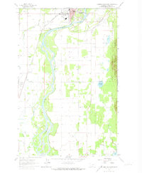
1962 Map of Columbia Falls South
USGS Topo · Published 1974About this map
The Flathead River carves a winding path through this corner of Montana, anchoring a landscape where river transport once met the steel of the Great Northern railroad. The community of Columbia Falls occupies the northern bend, serving as a gateway to the Flathead National Forest that rises to the east. The map reveals a cluster of social and civic infrastructure including the High Sch, City Hall, and the Drive-in Theater, reflecting mid-century growth. Further south, the presence of the Soldiers Home and a series of dedicated burial grounds, such as Soldiers Home Cem and St Richard Cem, provides significant detail for genealogical research. The valley floor is characterized by agricultural and rural development, punctuated by small community hubs like La Salle and the La Salle Grange Hall, alongside scattered educational sites like the Deer Park Sch and Lake Blaine Sch.
Find a feature on this map
27 named features on this map. Tap any name to fly to it.
Don’t see what you’re looking for? This feature index may not catch every label — zoom into the map to look around manually.
Map Details
Editions of this 1962 Columbia Falls South Map
3 editions found
Other maps of this area

1943 · Kalispell
USGS Topo · 1:125,000

1957 · Kalispell
USGS Topo · 1:250,000

1960 · Kalispell
USGS Topo · 1:250,000

1961 · Kalispell
USGS Topo · 1:250,000

1962 · Columbia Falls South
USGS Topo · 1:24,000

1962 · Doris Mountain
USGS Topo · 1:24,000

1962 · Rose Crossing
USGS Topo · 1:24,000

1962 · Hungry Horse
USGS Topo · 1:24,000

1962 · Creston
USGS Topo · 1:24,000

1962 · Hash Mountain
USGS Topo · 1:24,000