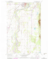
1962 Map of Columbia Falls South
USGS Topo · Published 1983About this map
The Flathead River dominates this landscape south of Columbia Falls, where the water snakes through a complex of side channels and wetlands like Morning Slough and Gouderich Bayou. This 1962 survey reveals a significant pocket of local history at the State Soldiers Home, which sits alongside its own Soldiers Home Cem and the Burlington Northern line. The map serves as a vital record for genealogists, documenting several burial grounds including St Richard Cem, Woodlawn Cem, and Fairview Cem.
Find a feature on this map
30 named features on this map. Tap any name to fly to it.
Don’t see what you’re looking for? This feature index may not catch every label — zoom into the map to look around manually.
Map Details
Editions of this 1962 Columbia Falls South Map
3 editions found
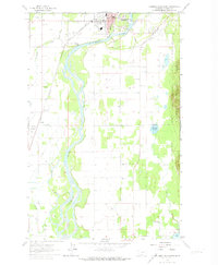
Other maps of this area

1943 · Kalispell
USGS Topo · 1:125,000

1957 · Kalispell
USGS Topo · 1:250,000

1960 · Kalispell
USGS Topo · 1:250,000

1961 · Kalispell
USGS Topo · 1:250,000

1962 · Columbia Falls South
USGS Topo · 1:24,000

1962 · Doris Mountain
USGS Topo · 1:24,000

1962 · Rose Crossing
USGS Topo · 1:24,000

1962 · Hungry Horse
USGS Topo · 1:24,000

1962 · Creston
USGS Topo · 1:24,000

1962 · Hash Mountain
USGS Topo · 1:24,000