
1970 Map of Columbia South
USGS Topo · Published 1972About this map
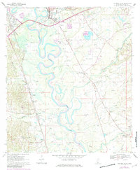
The Pearl River snakes through the center of this Marion County landscape, creating a complex network of oxbows and swampy bottomlands. Just south of the municipal center, the area shows a transition from the industrial and transport hub of Foxworth and the Columbia and Gulf Mobile railroad to a rural interior dotted with family-centered settlements and small churches. Community life is anchored by landmarks like St Paul Ch, Edna Ch, and the County Vocational Sch.
Find a feature on this map
43 named features on this map. Tap any name to fly to it.
Don’t see what you’re looking for? This feature index may not catch every label — zoom into the map to look around manually.
Map Details
Editions of this 1970 Columbia South Map
2 editions found
Other maps of this area

1953 · Hattiesburg
USGS Topo · 1:250,000

1958 · Hattiesburg
USGS Topo · 1:250,000

1969 · Baxterville SW
USGS Topo · 1:24,000

1969 · Pinebur
USGS Topo · 1:24,000

1970 · Sandy Hook NW
USGS Topo · 1:24,000
1970 · Dexter
USGS Topo · 1:24,000

1970 · Morgantown
USGS Topo · 1:24,000

1970 · Columbia North
USGS Topo · 1:24,000
1970 · Sandy Hook
USGS Topo · 1:24,000

1984 · Hattiesburg
USGS Topo · 1:250,000