
1951 Map of Columbiana
USGS Topo · Published 1953About this map
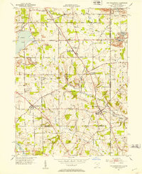
Columbiana sits at the heart of this survey of the Mahoning and Columbiana county line during the early 1950s. The landscape is a network of rural hamlets and agricultural townships, including North Lima, New Buffalo, and East Lewistown. Local infrastructure is defined by the Erie Railroad and the Youngstown And Southern tracks, which facilitated the region's transport long before modern highway expansion. Significant community landmarks like Firestone Park and the Lesher Airfield appear alongside numerous rural spiritual centers such as Pleasant View Ch Cem and Zion Hill Ch Cem. The drainage patterns of Mill Creek and Bull Creek flow through the townships, feeding into prominent water bodies like Pine Lake and Beaver Lake, illustrating the careful management of local water resources for the surrounding Fairfield and Beaver townships.
Find a feature on this map
54 named features on this map. Tap any name to fly to it.
Don’t see what you’re looking for? This feature index may not catch every label — zoom into the map to look around manually.
Map Details
Editions of this 1951 Columbiana Map
This is the sole edition of this map. No revisions or reprints were ever made.
Other maps of this area

1906 · Youngstown
USGS Topo · 1:62,500

1907 · Columbiana
USGS Topo · 1:62,500

1908 · Youngstown
USGS Topo · 1:62,500

1908 · Warren
USGS Topo · 1:62,500

1909 · Lisbon
USGS Topo · 1:62,500

1909 · Columbiana
USGS Topo · 1:62,500

1950 · Cleveland
USGS Topo · 1:250,000

1951 · Canton
USGS Topo · 1:250,000

1951 · Campbell
USGS Topo · 1:24,000
1951 · New Middletown
USGS Topo · 1:24,000