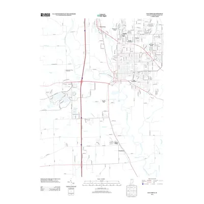
2013 Map of Columbus
USGS Topo · Published 2013About this map
The Driftwood River and Flatrock River converge in this central Indiana landscape, forming the headwaters of the E Fork White River. The map detailing this early 21st-century period shows the expanding footprint of Columbus, reaching from the established neighborhoods of North Columbus and East Columbus to newer residential clusters like Riverview Acres. To the west, the Strietelmeier Flying Field Airport and several lakes, including Terrace Lake and Crystal Lake, highlight the varied land use between the river bottoms and the growing suburbs. Further south, smaller communities like Garden City, Bethel Village, and Walesboro maintain their distinct identities along the highway corridors. The intricate network of drainage ditches and creeks, such as Denios Cr and Armuth Ditch, reveals the hydrological management required for this flat, fertile river valley.
Find a feature on this map
125 named features on this map. Tap any name to fly to it.
Don’t see what you’re looking for? This feature index may not catch every label — zoom into the map to look around manually.
Map Details
Editions of this 2013 Columbus Map
This is the sole edition of this map. No revisions or reprints were ever made.
Other maps of this area

1942 · Franklin
USGS Topo · 1:125,000

1942 · Columbus
USGS Topo · 1:125,000

1947 · Franklin
USGS Topo · 1:62,500

1947 · Hope
USGS Topo · 1:24,000

1948 · Edinburg
USGS Topo · 1:24,000

1948 · New Bellsville
USGS Topo · 1:24,000

1948 · Hope
USGS Topo · 1:24,000

1948 · Waymansville
USGS Topo · 1:24,000

1948 · Nineveh
USGS Topo · 1:24,000

1950 · Franklin
USGS Topo · 1:62,500