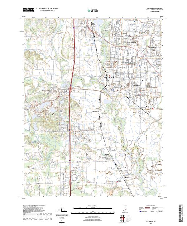
2022 Map of Columbus
USGS Topo · Published 2022About this map
Columbus serves as the focal point of this Indiana landscape where the Driftwood River and Flatrock River converge to form the East Fork White River. The city’s core is anchored by the Bartholomew County Courthouse, while residential expansion is evident in neighborhoods like Everroad Park, Parkside, and Riverview Acres. To the north, Ivy Tech Community College - Columbus marks the educational corridor, while the southern reaches transition into smaller settlements like Walesboro and Bethel Village.
Find a feature on this map
59 named features on this map. Tap any name to fly to it.
Don’t see what you’re looking for? This feature index may not catch every label — zoom into the map to look around manually.
Map Details
Editions of this 2022 Columbus Map
This is the sole edition of this map. No revisions or reprints were ever made.
Other maps of this area

1942 · Franklin
USGS Topo · 1:125,000

1942 · Columbus
USGS Topo · 1:125,000

1947 · Franklin
USGS Topo · 1:62,500

1947 · Hope
USGS Topo · 1:24,000

1948 · Edinburg
USGS Topo · 1:24,000

1948 · New Bellsville
USGS Topo · 1:24,000

1948 · Hope
USGS Topo · 1:24,000

1948 · Waymansville
USGS Topo · 1:24,000

1948 · Nineveh
USGS Topo · 1:24,000

1950 · Franklin
USGS Topo · 1:62,500