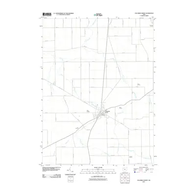
2010 Map of Columbus Grove
USGS Topo · Published 2010About this map
Columbus Grove serves as the central hub of this Putnam County landscape, where a dense grid of rural roads meets at the town's core. The drainage patterns of the region are clearly defined by the winding paths of Plum Creek, Cranberry Creek, and Sycamore Creek, which cut through the agricultural blocks. Local history is anchored by numerous burial grounds scattered across the township, including Saint Anthony Cemetery near the town center and more remote sites like Truro Cemetery and Wisely Cemetery. The presence of the Columbus Grove Post Office and a network of arterial routes such as Road R and Road M illustrate a community well-integrated with its surrounding farmland. The map reveals the precise layout of rural property access via an extensive numbered and lettered road system, typical of western Ohio's organized township structure.
Find a feature on this map
64 named features on this map. Tap any name to fly to it.
Don’t see what you’re looking for? This feature index may not catch every label — zoom into the map to look around manually.
Map Details
Editions of this 2010 Columbus Grove Map
This is the sole edition of this map. No revisions or reprints were ever made.
Other maps of this area

1906 · Columbus Grove
USGS Topo · 1:62,500

1907 · Bluffton
USGS Topo · 1:62,500

1908 · Columbus Grove
USGS Topo · 1:62,500

1908 · Ottawa
USGS Topo · 1:62,500

1950 · Marion
USGS Topo · 1:250,000

1953 · Fort Wayne
USGS Topo · 1:250,000

1953 · Muncie
USGS Topo · 1:250,000

1956 · Muncie
USGS Topo · 1:250,000

1956 · Fort Wayne
USGS Topo · 1:250,000

1956 · Toledo
USGS Topo · 1:250,000