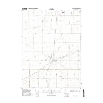
2016 Map of Columbus Grove
USGS Topo · Published 2016About this map
Columbus Grove and the southern outskirts of Ottawa anchor this Putnam County landscape, where a dense grid of township and county roads reflects the agricultural efficiency of northwest Ohio. The terrain is defined by the winding paths of Plum Cr and Cranberry Cr, which cut across the surveyed section lines. These waterways provided the natural drainage essential for the region's farming success, while the intersection of Old State Hwy 65 and local routes shaped the growth of the villages. Several rural burial grounds, including Wisely Cem and Saint Anthony Cem, are scattered across the townships, offering valuable markers for family historians. The map also captures the boundary between Putnam Co and Allen Co to the south, illustrating how political lines and natural features like Sycamore Cr interact within this productive till plain.
Find a feature on this map
120 named features on this map. Tap any name to fly to it.
Don’t see what you’re looking for? This feature index may not catch every label — zoom into the map to look around manually.
Map Details
Editions of this 2016 Columbus Grove Map
This is the sole edition of this map. No revisions or reprints were ever made.
Other maps of this area

1906 · Columbus Grove
USGS Topo · 1:62,500

1907 · Bluffton
USGS Topo · 1:62,500

1908 · Columbus Grove
USGS Topo · 1:62,500

1908 · Ottawa
USGS Topo · 1:62,500

1950 · Marion
USGS Topo · 1:250,000

1953 · Fort Wayne
USGS Topo · 1:250,000

1953 · Muncie
USGS Topo · 1:250,000

1956 · Muncie
USGS Topo · 1:250,000

1956 · Fort Wayne
USGS Topo · 1:250,000

1956 · Toledo
USGS Topo · 1:250,000