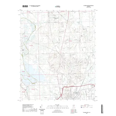
2020 Map of Columbus North
USGS Topo · Published 2020About this map
Columbus AFB dominates the northern landscape of this Lowndes County region, situated amidst a complex network of waterways that define the local geography. The Tombigbee River winds along the western edge, accompanied by numerous engineered channels such as the Town Creek Cutoff, Stinson Creek Cutoff, and Waverly Ferry Cutoff. These alterations to the natural flow reflect the long-term management of the river system for navigation and flood control. Along the river's path, distinctive landmarks like Mullens Bluff and Plymouth Bluff provide topographical variation near Columbus Lake.
Find a feature on this map
199 named features on this map. Tap any name to fly to it.
Don’t see what you’re looking for? This feature index may not catch every label — zoom into the map to look around manually.
Map Details
Editions of this 2020 Columbus North Map
This is the sole edition of this map. No revisions or reprints were ever made.
Other maps of this area

1953 · West Point
USGS Topo · 1:250,000

1958 · West Point
USGS Topo · 1:250,000

1959 · Artesia
USGS Topo · 1:62,500

1959 · West Point
USGS Topo · 1:62,500

1960 · Caledonia
USGS Topo · 1:62,500

1960 · Columbus
USGS Topo · 1:62,500

1963 · West Point
USGS Topo · 1:250,000

1982 · West Point
USGS Topo · 1:100,000

1984 · West Point
USGS Topo · 1:250,000
1987 · Hamilton
USGS Topo · 1:24,000