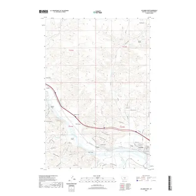
2020 Map of Columbus West
USGS Topo · Published 2020About this map
Columbus serves as the focal point of this western Stillwater County landscape, situated at the significant confluence where the Stillwater River joins the Yellowstone River. The town's administrative role is marked by the Stillwater County Courthouse, while its local history is anchored by the Mountain View Cem on the western outskirts. The geography is defined by a series of deep coulees and gulches, including Wildcat Coulee, Baney Coulee, and Stump Gulch, which carve through the high ground north of the river valley.
Find a feature on this map
67 named features on this map. Tap any name to fly to it.
Don’t see what you’re looking for? This feature index may not catch every label — zoom into the map to look around manually.
Map Details
Editions of this 2020 Columbus West Map
This is the sole edition of this map. No revisions or reprints were ever made.
Other maps of this area

1892 · Stillwater
USGS Topo · 1:125,000

1954 · Billings
USGS Topo · 1:250,000

1955 · Antelope Point
USGS Topo · 1:24,000

1955 · Springtime
USGS Topo · 1:24,000

1955 · Whitebird School
USGS Topo · 1:24,000

1955 · Absarokee
USGS Topo · 1:24,000

1956 · Columbus West
USGS Topo · 1:24,000

1956 · Shane Ridge
USGS Topo · 1:24,000

1956 · Columbus East
USGS Topo · 1:24,000

1956 · Lindemulder Hill
USGS Topo · 1:24,000
Featured Places
- Columbus, MT
- H and H Trailer Court, Columbus
- Valley Vista Trailer Park, Columbus
- Stillwater County, MT
- United States