
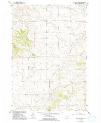
1955 Map of Antelope Point
USGS Topo · Published 1957About this map
Antelope Point rises as a prominent landmark in this Stillwater County landscape, which was mapped in the mid-1950s as part of the Department of the Interior’s program for the Missouri River Basin. The area is defined by a series of drainage systems, including Sheep Creek, White Beaver Creek, and Cottonwood Creek, which cut through the high plains. A network of rural education is visible across the townships, anchored by the Antelope Point Sch, Patten Sch, and Cottonwood Sch. These small schoolhouses, spaced miles apart, indicate the decentralized ranching and farming community of the era. The land is further marked by a significant Pipeline crossing the northern sections and a Spillway near the center, reflecting mid-century utility infrastructure. Topographically, the map transitions from the elevation of Stephens Hill in the west toward the drainages in the east, all oriented around the Montana Base Line.
Find a feature on this map
17 named features on this map. Tap any name to fly to it.
Don’t see what you’re looking for? This feature index may not catch every label — zoom into the map to look around manually.
Map Details
Editions of this 1955 Antelope Point Map
2 editions found
Other maps of this area

1891 · Big Timber
USGS Topo · 1:125,000

1892 · Stillwater
USGS Topo · 1:125,000

1893 · Big Timber
USGS Topo · 1:125,000

1954 · Billings
USGS Topo · 1:250,000

1955 · Reed Point
USGS Topo · 1:24,000

1955 · Springtime
USGS Topo · 1:24,000

1955 · Russell Gulch
USGS Topo · 1:24,000

1955 · Stephens Hill
USGS Topo · 1:24,000

1956 · Columbus West
USGS Topo · 1:24,000

1956 · Rapelje
USGS Topo · 1:24,000