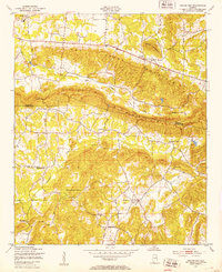
1947 Map of Colvin Gap
USGS Topo · Published 1953About this map
Colvin Mountain and Dry Creek Mountain dominate the topography of this Northeast Alabama corridor, creating a series of enclosed valleys where rural life centered around local churches and schools in the late 1940s. The settlement of Hokes Bluff sits at the northwestern edge, while the crossing at Colvin Gap provides a vital link through the ridges. The map reveals a landscape defined by small-scale farming and spiritual life, evidenced by a dense network of country churches including Youngs Chapel, New Liberty Ch, and Pattersons Chapel.
Find a feature on this map
19 named features on this map. Tap any name to fly to it.
Don’t see what you’re looking for? This feature index may not catch every label — zoom into the map to look around manually.
Map Details
Editions of this 1947 Colvin Gap Map
2 editions found
Other maps of this area

1893 · Fort Payne
USGS Topo · 1:125,000

1898 · Fort Payne
USGS Topo · 1:125,000

1900 · Fort Payne
USGS Topo · 1:125,000

1900 · Anniston
USGS Topo · 1:125,000

1947 · Colvin Gap
USGS Topo · 1:24,000

1947 · Jacksonville
USGS Topo · 1:24,000

1947 · Glencoe
USGS Topo · 1:24,000

1947 · Wellington
USGS Topo · 1:24,000

1947 · Jacksonville
USGS Topo · 1:62,500

1953 · Atlanta
USGS Topo · 1:250,000