
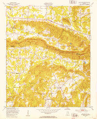
1947 Map of Colvin Gap
USGS Topo · Published 1953About this map
Colvin Mountain dominates the center of this mid-century quadrangle, creating a natural topographic barrier that directed the early settlement patterns of rural Alabama. In the immediate post-war years, this area near the Etowah Co Calhoun Co line was defined by a network of small community institutions and family landmarks. The map records several vital focal points for local history, including Youngs Chapel, New Liberty Ch, and the Websters Sch.
Find a feature on this map
20 named features on this map. Tap any name to fly to it.
Don’t see what you’re looking for? This feature index may not catch every label — zoom into the map to look around manually.
Map Details
Editions of this 1947 Colvin Gap Map
2 editions found
Other maps of this area

1893 · Fort Payne
USGS Topo · 1:125,000

1898 · Fort Payne
USGS Topo · 1:125,000

1900 · Fort Payne
USGS Topo · 1:125,000

1900 · Anniston
USGS Topo · 1:125,000

1947 · Jacksonville
USGS Topo · 1:24,000

1947 · Glencoe
USGS Topo · 1:24,000

1947 · Wellington
USGS Topo · 1:24,000

1947 · Jacksonville
USGS Topo · 1:62,500

1953 · Atlanta
USGS Topo · 1:250,000

1955 · Rome
USGS Topo · 1:250,000