
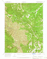
1957 Map of Colyear Springs
USGS Topo · Published 1959About this map
Colyear Springs and the surrounding reaches of Tehama County are shown here as they appeared in the late 1950s, characterized by a complex network of homesteads and remote grazing flats within the Mendocino National Forest and Trinity Nat Forest. The map reveals a deeply localized landscape where geographic identification relied heavily on family names, such as the Pettyjohn Place, Hatfield Place, and Swain Place. This nomenclature suggests a period of dispersed settlement and agricultural activity centered on the numerous flats and springs.
Find a feature on this map
155 named features on this map. Tap any name to fly to it.
Don’t see what you’re looking for? This feature index may not catch every label — zoom into the map to look around manually.
Map Details
Editions of this 1957 Colyear Springs Map
2 editions found
Other maps of this area

1890 · Red Bluff
USGS Topo · 1:250,000

1894 · Red Bluff
USGS Topo · 1:250,000

1944 · Flournoy
USGS Topo · 1:62,500

1947 · Anderson
USGS Topo · 1:62,500

1948 · Anderson
USGS Topo · 1:62,500

1949 · Colyear Springs
USGS Topo · 1:62,500

1951 · Chanchelulla Peak
USGS Topo · 1:62,500

1952 · Blossom
USGS Topo · 1:24,000

1952 · Red Bank
USGS Topo · 1:24,000

1952 · Paskenta
USGS Topo · 1:62,500