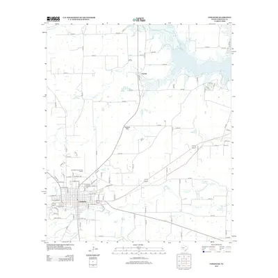
2012 Map of Comanche
USGS Topo · Published 2012About this map
Comanche serves as the primary hub for this Central Texas landscape, shown here as a grid of streets and municipal infrastructure just north of Indian Cr. The surrounding countryside is defined by agricultural tracts and a series of significant water bodies, most notably the expansive Proctor Lake in the northeast and smaller private reservoirs like Bingham Brothers Lake and McGuire Lake. For genealogists and local historians, several community burial grounds are documented, including Oakwood Cem on the north side of town and more remote sites such as Zion Hill Cem and Antioch Cem. Smaller settlements like Vandyke and Gartman View mark the transition from the city center to the rural creek basins of Duncan Cr and Dargan Cr, reflecting the region's enduring rural character and its reliance on local water sources and county road networks.
Find a feature on this map
107 named features on this map. Tap any name to fly to it.
Don’t see what you’re looking for? This feature index may not catch every label — zoom into the map to look around manually.
Map Details
Editions of this 2012 Comanche Map
This is the sole edition of this map. No revisions or reprints were ever made.
Other maps of this area

1888 · Hamilton
USGS Topo · 1:125,000

1889 · Brownwood
USGS Topo · 1:125,000

1890 · Stephenville
USGS Topo · 1:125,000

1894 · Hamilton
USGS Topo · 1:125,000

1894 · Eastland
USGS Topo · 1:125,000

1894 · Brownwood
USGS Topo · 1:125,000

1920 · Stephenville
USGS Topo · 1:125,000

1954 · Brownwood
USGS Topo · 1:250,000

1954 · Abilene
USGS Topo · 1:250,000

1956 · Gustine
USGS Topo · 1:62,500