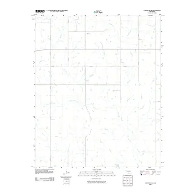
2009 Map of Comanche SE
USGS Topo · Published 2009About this map
Mud Creek and Deer Creek dominate this rural landscape in southern Oklahoma, where a dense network of sectional roads like E 1850 Rd and N 2900 Rd divide the territory into a traditional grid. The local economy and history are visible in the northern reaches of the quadrangle, where the Palacine Oil Field signifies the region's long-standing connection to petroleum extraction. This is a landscape of low-lying drainage and intermittent water bodies, shaped by the tributaries of the Red River basin. Genealogists may find particular value in the location of Woolsey Cemetery, situated just off E 1860 Rd. The map illustrates a modern era of Oklahoma's rural development, where established section lines and agricultural allotments surround the natural winding paths of South Fork Deer Creek and its neighboring streams.
Find a feature on this map
21 named features on this map. Tap any name to fly to it.
Don’t see what you’re looking for? This feature index may not catch every label — zoom into the map to look around manually.
Map Details
Editions of this 2009 Comanche SE Map
This is the sole edition of this map. No revisions or reprints were ever made.
Other maps of this area

1901 · Addington
USGS Topo · 1:125,000

1957 · Ardmore
USGS Topo · 1:250,000

1962 · Ryan
USGS Topo · 1:62,500

1963 · Ardmore
USGS Topo · 1:250,000

1963 · Harrisburg
USGS Topo · 1:24,000

1964 · Comanche SE
USGS Topo · 1:24,000

1964 · Duncan South
USGS Topo · 1:24,000

1964 · Comanche
USGS Topo · 1:24,000

1974 · Ringling NW
USGS Topo · 1:24,000

1974 · Loco
USGS Topo · 1:24,000