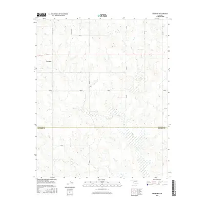
2016 Map of Comanche SE
USGS Topo · Published 2016About this map
Comanche sits at the western edge of this 2016 survey, which highlights the transition between the rolling uplands of Stephens County and Jefferson County. The landscape is defined by the headwaters of the Mud Creek system, where W Mud Cr and E Mud Cr converge into Mud Creek, creating a broad drainage network that dominates the southeastern quadrant. The small settlement of Woolsey serves as a local focal point near the center of the sheet, and the nearby Woolsey Cem provides a tangible link for those tracing family roots in this rural stretch of southern Oklahoma. An established grid of ranch and chapel roads, such as Woodward Ranch Rd and Weaver Chapel Rd, navigates the complex terrain of the Deer Cr and S Fork Deer Cr watersheds.
Find a feature on this map
22 named features on this map. Tap any name to fly to it.
Don’t see what you’re looking for? This feature index may not catch every label — zoom into the map to look around manually.
Map Details
Editions of this 2016 Comanche SE Map
This is the sole edition of this map. No revisions or reprints were ever made.
Other maps of this area

1901 · Addington
USGS Topo · 1:125,000

1957 · Ardmore
USGS Topo · 1:250,000

1962 · Ryan
USGS Topo · 1:62,500

1963 · Ardmore
USGS Topo · 1:250,000

1963 · Harrisburg
USGS Topo · 1:24,000

1964 · Comanche SE
USGS Topo · 1:24,000

1964 · Duncan South
USGS Topo · 1:24,000

1964 · Comanche
USGS Topo · 1:24,000

1974 · Ringling NW
USGS Topo · 1:24,000

1974 · Loco
USGS Topo · 1:24,000