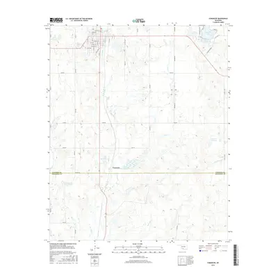
2016 Map of Comanche
USGS Topo · Published 2016About this map
Comanche anchors the northern portion of this survey, where a structured street grid of avenues and numbered streets like Wilson Ave and S 7th St meets the rural agricultural landscape of Stephens County. The town is situated just north of the border shared by Stephens Co and Jefferson Co, serving as a regional hub defined by its proximity to several significant water management systems. The landscape is heavily shaped by hydrological engineering, notably the series of numbered impoundments such as Cow Creek Site 28 Reservoir and Cow Cr Site 29 Reservoir along the winding path of Cow Creek. To the northeast, the recreational and utility value of Comanche Lake and Comanche Reservoir are prominent, while several smaller, unnamed reservoirs designated by identifiers like 137072 Reservoir dot the terrain, illustrating the critical role of water retention in this part of Oklahoma.
Find a feature on this map
53 named features on this map. Tap any name to fly to it.
Don’t see what you’re looking for? This feature index may not catch every label — zoom into the map to look around manually.
Map Details
Editions of this 2016 Comanche Map
This is the sole edition of this map. No revisions or reprints were ever made.
Other maps of this area

1901 · Addington
USGS Topo · 1:125,000

1955 · Lawton
USGS Topo · 1:250,000

1957 · Hastings
USGS Topo · 1:62,500

1957 · Ardmore
USGS Topo · 1:250,000

1962 · Ryan
USGS Topo · 1:62,500

1962 · Temple
USGS Topo · 1:62,500

1963 · Ardmore
USGS Topo · 1:250,000

1963 · Harrisburg
USGS Topo · 1:24,000

1964 · Comanche SE
USGS Topo · 1:24,000

1964 · Duncan South
USGS Topo · 1:24,000