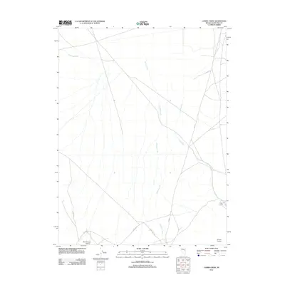
2012 Map of Combs Creek
USGS Topo · Published 2012About this map
Kerr Ranch stands as a lonely outpost in this arid corner of White Pine County, where water drainage defines the geography of the high desert. The landscape is carved by seasonal watercourses, most notably Combs Creek and Bothwick Creek, which flow toward the north alongside White Sage Wash. The southern edge of the quadrangle is marked by more varied relief where the drainage narrows into Rock Spring Canyon and Bradley Canyon.
Find a feature on this map
10 named features on this map. Tap any name to fly to it.
Don’t see what you’re looking for? This feature index may not catch every label — zoom into the map to look around manually.
Map Details
Editions of this 2012 Combs Creek Map
This is the sole edition of this map. No revisions or reprints were ever made.
Other maps of this area

1952 · Ely
USGS Topo · 1:125,000

1956 · Ely
USGS Topo · 1:250,000

1958 · McGill
USGS Topo · 1:62,500

1959 · Ely
USGS Topo · 1:250,000

1959 · Reipetown
USGS Topo · 1:62,500
1962 · Hunter Point
USGS Topo · 1:24,000

1963 · Ely
USGS Topo · 1:250,000

1979 · Mt. Hamilton
USGS Topo · 1:100,000

1982 · White Sage Well
USGS Topo · 1:24,000
1982 · Steptoe Ranch
USGS Topo · 1:24,000