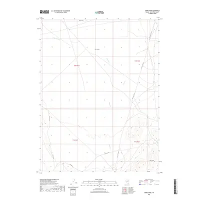
2018 Map of Combs Creek
USGS Topo · Published 2018About this map
Butte Valley and the northern reaches of the Egan Range dominate this landscape in White Pine County, showing a classic Great Basin basin-and-range profile. The map documents a high-desert environment defined by drainage systems like White Sage Wash, Combs Cr, and Bothwick Cr, which flow toward the flat basin floor from the surrounding uplands. Evidence of land use is centered on a sparse network of ranching and access routes, including Thirty Mile Rd and Bothwick Rd. The presence of Hunter Flat in the north suggests the typical alkaline flats or seasonally dry playas common to the region. This 2018 data provides a precise record of the public land survey system divisions and the primary thoroughfare, White Pine Co Road 19, as it skirts the eastern edge of the valley floor.
Find a feature on this map
14 named features on this map. Tap any name to fly to it.
Don’t see what you’re looking for? This feature index may not catch every label — zoom into the map to look around manually.
Map Details
Editions of this 2018 Combs Creek Map
This is the sole edition of this map. No revisions or reprints were ever made.
Other maps of this area

1952 · Ely
USGS Topo · 1:125,000

1956 · Ely
USGS Topo · 1:250,000

1958 · McGill
USGS Topo · 1:62,500

1959 · Ely
USGS Topo · 1:250,000

1959 · Reipetown
USGS Topo · 1:62,500
1962 · Hunter Point
USGS Topo · 1:24,000

1963 · Ely
USGS Topo · 1:250,000

1979 · Mt. Hamilton
USGS Topo · 1:100,000

1982 · White Sage Well
USGS Topo · 1:24,000
1982 · Steptoe Ranch
USGS Topo · 1:24,000