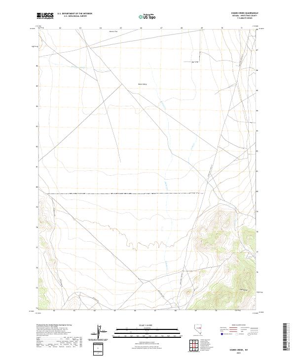
2021 Map of Combs Creek
USGS Topo · Published 2021About this map
Butte Valley and the northern reaches of the Egan Range define the topography of this high desert region in White Pine County. The landscape is characterized by its drainage patterns, with White Sage Wash, Bothwick Cr, and Combs Cr carving paths through the terrain. Human presence is marked by a network of rural routes including Thirty Mile Rd and White Pine Co Road 19, which provide access across the wide expanse of Hunter Flat. The map reflects the enduring importance of the Public Land Survey System in this part of Nevada, clearly showing township boundaries such as t20n r61e and t19n r62e. This survey provides a look at the remote interior basins before further modernization altered these traditional grazing and transit corridors.
Find a feature on this map
14 named features on this map. Tap any name to fly to it.
Don’t see what you’re looking for? This feature index may not catch every label — zoom into the map to look around manually.
Map Details
Editions of this 2021 Combs Creek Map
This is the sole edition of this map. No revisions or reprints were ever made.
Other maps of this area

1952 · Ely
USGS Topo · 1:125,000

1956 · Ely
USGS Topo · 1:250,000

1958 · McGill
USGS Topo · 1:62,500

1959 · Ely
USGS Topo · 1:250,000

1959 · Reipetown
USGS Topo · 1:62,500
1962 · Hunter Point
USGS Topo · 1:24,000

1963 · Ely
USGS Topo · 1:250,000

1979 · Mt. Hamilton
USGS Topo · 1:100,000

1982 · White Sage Well
USGS Topo · 1:24,000
1982 · Steptoe Ranch
USGS Topo · 1:24,000