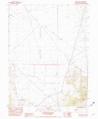
1982 Map of Combs Creek
USGS Topo · Published 1982About this map
Butte Valley dominates the western half of this Nevada landscape, where the wide, flat basin meets the rising slopes of the Egan Range to the east. This 1982 survey reveals a remote ranching and resource-based environment, centered around Kerr Ranch and its vital water sources like Combs Creek and Bothwick Creek. The map provides a clear picture of the arid drainage patterns, from the White Sage Wash to the north to the confined topography of Bradley Canyon. Evidence of human activity is scattered across the terrain in the form of a Corral and Marking Corral, alongside markers of industrial potential such as a Gulf Well, a Prospect, and a Borrow Pit. This area reflects the late twentieth-century high-desert landscape of White Pine County, defined by its ranching infrastructure and seasonal water infrastructure like the local Spring and Water Tank.
Find a feature on this map
15 named features on this map. Tap any name to fly to it.
Don’t see what you’re looking for? This feature index may not catch every label — zoom into the map to look around manually.
Map Details
Editions of this 1982 Combs Creek Map
This is the sole edition of this map. No revisions or reprints were ever made.
Other maps of this area

1952 · Ely
USGS Topo · 1:125,000

1956 · Ely
USGS Topo · 1:250,000

1958 · McGill
USGS Topo · 1:62,500

1959 · Ely
USGS Topo · 1:250,000

1959 · Reipetown
USGS Topo · 1:62,500
1962 · Hunter Point
USGS Topo · 1:24,000

1963 · Ely
USGS Topo · 1:250,000

1979 · Mt. Hamilton
USGS Topo · 1:100,000

1982 · White Sage Well
USGS Topo · 1:24,000
1982 · Steptoe Ranch
USGS Topo · 1:24,000