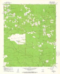
1960 Map of Cominto
USGS Topo · Published 1961About this map
The Missouri Pacific railroad cuts a diagonal path through this corner of Drew County, anchoring a series of small settlements including Killin, Enon, and Deane. At the northern edge of this 1960 survey, a Experiment Station and a designated Sewage Disposal area reflect the local infrastructure near the edge of more developed tracts. The landscape is defined by an intricate network of waterways, with Sandy Creek and Wolf Creek branching out to drain the wooded terrain.
Find a feature on this map
31 named features on this map. Tap any name to fly to it.
Don’t see what you’re looking for? This feature index may not catch every label — zoom into the map to look around manually.
Map Details
Editions of this 1960 Cominto Map
2 editions found

Other maps of this area

1935 · Mist
USGS Topo · 1:62,500

1935 · Cominto
USGS Topo · 1:62,500

1953 · Greenwood
USGS Topo · 1:250,000

1956 · Greenwood
USGS Topo · 1:250,000

1960 · Mist
USGS Topo · 1:62,500

1960 · Selma
USGS Topo · 1:24,000

1960 · Collins NW
USGS Topo · 1:24,000

1960 · Collins
USGS Topo · 1:24,000

1960 · Collins
USGS Topo · 1:62,500
1960 · Line
USGS Topo · 1:24,000