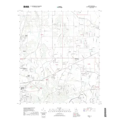
2018 Map of Comite
USGS Topo · Published 2018About this map
The Comite River meanders through this portion of East Baton Rouge Parish, creating a complex corridor of wetlands and bayous such as White Bayou and Beaver Bayou. The landscape transition is evident as the suburban expansion of Baton Rouge and Baker meets established rural communities like Central and Puckett. For genealogists, the map is particularly useful for locating smaller family burial grounds dispersed among the residential developments, including Edwards Cem near Tanglewood and Devall Cem further south. The proximity of Clark Field to residential clusters like Brown Heights reflects the mixed-use character of the area in 2018. Major thoroughfares such as the Central Thruway and Greenwell Springs Rd connect these outlying settlements to the urban core of Zion City and Greendale.
Find a feature on this map
106 named features on this map. Tap any name to fly to it.
Don’t see what you’re looking for? This feature index may not catch every label — zoom into the map to look around manually.
Map Details
Editions of this 2018 Comite Map
This is the sole edition of this map. No revisions or reprints were ever made.
Other maps of this area

1906 · Bayou Sara
USGS Topo · 1:125,000

1908 · Baton Rouge
USGS Topo · 1:62,500

1934 · Denham Springs
USGS Topo · 1:62,500

1939 · Zachary
USGS Topo · 1:62,500

1939 · Denham Springs
USGS Topo · 1:62,500

1939 · Baton Rouge
USGS Topo · 1:62,500

1942 · Pride
USGS Topo · 1:31,680

1942 · Watson
USGS Topo · 1:31,680

1953 · Baton Rouge West
USGS Topo · 1:24,000
1953 · Baton Rouge East
USGS Topo · 1:24,000