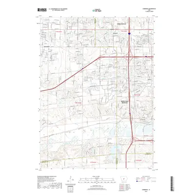
2018 Map of Commerce
USGS Topo · Published 2018About this map
West Des Moines and its surrounding communities are captured in this 2018 survey during a period of extensive suburban development. The map details the intricate network of residential streets and commercial thoroughfares like Hickman Rd and University Ave that connect Waukee, Clive, and Urbandale. Despite the modern expansion, traces of the area's agricultural and early settlement roots remain visible, particularly in the south near the Raccoon River.
Find a feature on this map
38 named features on this map. Tap any name to fly to it.
Don’t see what you’re looking for? This feature index may not catch every label — zoom into the map to look around manually.
Map Details
Editions of this 2018 Commerce Map
This is the sole edition of this map. No revisions or reprints were ever made.
Other maps of this area

1905 · Des Moines
USGS Topo · 1:62,500

1907 · Des Moines
USGS Topo · 1:62,500

1908 · Waukee
USGS Topo · 1:62,500

1931 · Indianola
USGS Topo · 1:62,500

1951 · St. Charles
USGS Topo · 1:62,500

1954 · Des Moines
USGS Topo · 1:250,000

1956 · Des Moines
USGS Topo · 1:250,000

1956 · Des Moines NW
USGS Topo · 1:24,000

1956 · Des Moines SW
USGS Topo · 1:24,000

1956 · Des Moines
USGS Topo · 1:62,500