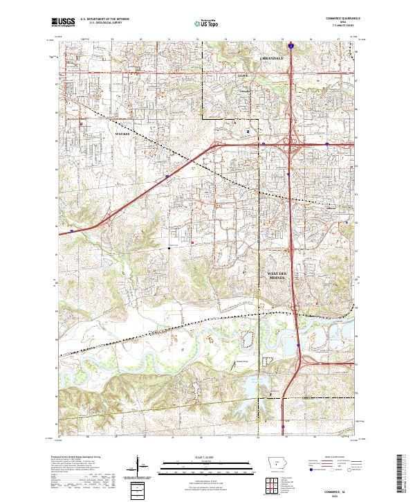
2022 Map of Commerce
USGS Topo · Published 2022About this map
The Raccoon River and its major tributaries, including Sugar Creek and Walnut Creek, define the topography of this transitional landscape west of the state capital. The settlement at Commerce sits along the river's northern bend, while Ashawa marks a distinct point of historical interest near the developing municipal boundaries of West Des Moines, Urbandale, and Clive. These burgeoning suburbs are mapped alongside older landmarks such as Huston Cemetery and Hobbes Field.
Find a feature on this map
44 named features on this map. Tap any name to fly to it.
Don’t see what you’re looking for? This feature index may not catch every label — zoom into the map to look around manually.
Map Details
Editions of this 2022 Commerce Map
This is the sole edition of this map. No revisions or reprints were ever made.
Other maps of this area

1905 · Des Moines
USGS Topo · 1:62,500

1907 · Des Moines
USGS Topo · 1:62,500

1908 · Waukee
USGS Topo · 1:62,500

1931 · Indianola
USGS Topo · 1:62,500

1951 · St. Charles
USGS Topo · 1:62,500

1954 · Des Moines
USGS Topo · 1:250,000

1956 · Des Moines
USGS Topo · 1:250,000

1956 · Des Moines NW
USGS Topo · 1:24,000

1956 · Des Moines SW
USGS Topo · 1:24,000

1956 · Des Moines
USGS Topo · 1:62,500