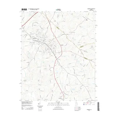
2014 Map of Commerce
USGS Topo · Published 2014About this map
The city of Commerce serves as a central hub in this Northeast Georgia landscape, where the borders of Jackson, Banks, and Madison Counties converge. The topography is defined by the winding course of the North Oconee River and numerous tributaries like Beaverdam Cr and Sandy Cr. These waterways are punctuated by a series of numbered reservoirs, including Reservoir 44, Reservoir 15, and Reservoir 23, which suggest a developed water management system across the rolling terrain.
Find a feature on this map
195 named features on this map. Tap any name to fly to it.
Don’t see what you’re looking for? This feature index may not catch every label — zoom into the map to look around manually.
Map Details
Editions of this 2014 Commerce Map
This is the sole edition of this map. No revisions or reprints were ever made.
Other maps of this area

1891 · Gainesville
USGS Topo · 1:125,000

1891 · Carnesville
USGS Topo · 1:125,000

1954 · Greenville
USGS Topo · 1:250,000

1958 · Greenville
USGS Topo · 1:250,000

1964 · Commerce
USGS Topo · 1:24,000

1964 · Maysville
USGS Topo · 1:24,000

1964 · Ila
USGS Topo · 1:24,000

1964 · Ashland
USGS Topo · 1:24,000
1964 · Nicholson
USGS Topo · 1:24,000

1964 · Hull
USGS Topo · 1:24,000