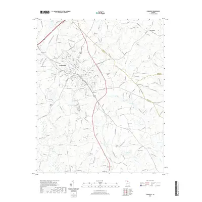
2020 Map of Commerce
USGS Topo · Published 2020About this map
The city of Commerce serves as a central hub in this modern survey of Jackson County, appearing at a time of significant road development near the intersection of several regional routes. The map documents a transition from the established street grid of the town center to more modern additions like Steven B Tanger Blvd and industrial zones. Beyond the urban core, the landscape is defined by the headwaters of the North Fork Oconee River and numerous small impoundments such as Marlow Lake and Iveys Lake. Genealogists will find a high density of rural burial grounds preserved in the surrounding hills, including Harmony Cem, Mount Olive Cem, and the Cabin Creek Cem near Nicholson. This survey also captures the exact county lines where Jackson, Banks, and Madison counties converge near Five Points and Black Cr.
Find a feature on this map
198 named features on this map. Tap any name to fly to it.
Don’t see what you’re looking for? This feature index may not catch every label — zoom into the map to look around manually.
Map Details
Editions of this 2020 Commerce Map
This is the sole edition of this map. No revisions or reprints were ever made.
Other maps of this area

1891 · Gainesville
USGS Topo · 1:125,000

1891 · Carnesville
USGS Topo · 1:125,000

1954 · Greenville
USGS Topo · 1:250,000

1958 · Greenville
USGS Topo · 1:250,000

1964 · Commerce
USGS Topo · 1:24,000

1964 · Maysville
USGS Topo · 1:24,000

1964 · Ila
USGS Topo · 1:24,000

1964 · Ashland
USGS Topo · 1:24,000
1964 · Nicholson
USGS Topo · 1:24,000

1964 · Hull
USGS Topo · 1:24,000