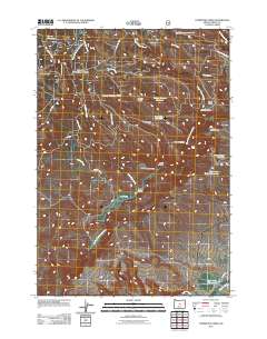
2011 Map of Committee Creek
USGS Topo · Published 2011About this map
Teaters Ranch and the open reach of Horse Prairie anchor this high-desert landscape in Crook County, where water management defines the local geography. The area is characterized by a network of drainage systems and man-made impoundments, ranging from the large Lutsey Reservoir in the northwest to more descriptive features like the Hole-in-the-Ground Reservoir. Steep elevation changes are marked by distinct landforms such as Cabin Butte, Battle Point, and the ominous Funeral Ridge.
Find a feature on this map
35 named features on this map. Tap any name to fly to it.
Don’t see what you’re looking for? This feature index may not catch every label — zoom into the map to look around manually.
Map Details
Editions of this 2011 Committee Creek Map
This is the sole edition of this map. No revisions or reprints were ever made.
Other maps of this area

1951 · Post
USGS Topo · 1:62,500

1951 · Lookout Mtn
USGS Topo · 1:62,500

1955 · Bend
USGS Topo · 1:250,000

1957 · Bend
USGS Topo · 1:250,000

1958 · Bend
USGS Topo · 1:250,000

1965 · Williams Prairie
USGS Topo · 1:24,000

1966 · Keys Creek
USGS Topo · 1:24,000

1981 · Prineville
USGS Topo · 1:100,000

1982 · Arrowwood Point
USGS Topo · 1:24,000
1982 · Rabbit Valley
USGS Topo · 1:24,000