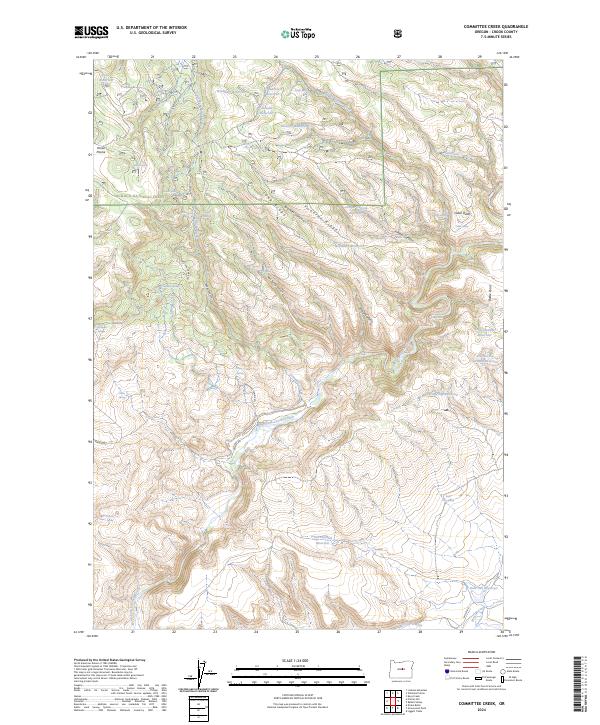
2024 Map of Committee Creek
USGS Topo · Published 2024About this map
The North Fork Crooked Wild and Scenic River carves a deep path through this portion of the Ochoco National Forest, defining a landscape where water management is critical to the high-desert environment. This 2024 map documents an extensive network of small upland impoundments, such as Lutsey Reservoir, Old Faithful Reservoir, and the descriptively named Hold-in-the-Ground Reservoir. These features, alongside numerous springs like Telephone Springs and Committee Spring, suggest a long history of range management and livestock grazing across Horse Prairie.
Find a feature on this map
51 named features on this map. Tap any name to fly to it.
Don’t see what you’re looking for? This feature index may not catch every label — zoom into the map to look around manually.
Map Details
Editions of this 2024 Committee Creek Map
This is the sole edition of this map. No revisions or reprints were ever made.
Other maps of this area

1951 · Post
USGS Topo · 1:62,500

1951 · Lookout Mtn
USGS Topo · 1:62,500

1955 · Bend
USGS Topo · 1:250,000

1957 · Bend
USGS Topo · 1:250,000

1958 · Bend
USGS Topo · 1:250,000

1965 · Williams Prairie
USGS Topo · 1:24,000

1966 · Keys Creek
USGS Topo · 1:24,000

1981 · Prineville
USGS Topo · 1:100,000

1982 · Arrowwood Point
USGS Topo · 1:24,000
1982 · Rabbit Valley
USGS Topo · 1:24,000