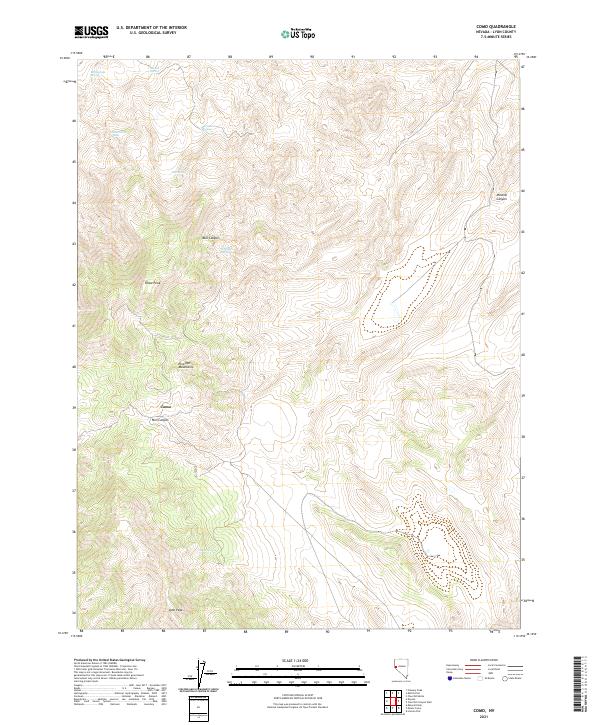
2021 Map of Como
USGS Topo · Published 2021About this map
The Pine Nut Mountains dominate this high-desert terrain in Lyon County, centered on the high-elevation settlement of Como. This area is characterized by an intricate network of deep drainages including Mill Canyon, Bull Canyon, and Mineral Canyon, which cut through the steep slopes between Rawe Peak and the southern Lyon Peak. The landscape's hydrology is defined by numerous isolated water sources critical to the region's history, such as Stone Spring, Bull Spring, and Cottonwood Spring. These scattered springs and the challenging topography of the Pine Nut Mountains reflect a remote Nevada interior shaped by small-scale mining and ranching interests, where seasonal water access dictated the viability of high-country settlements and travel routes between the mountain peaks.
Find a feature on this map
18 named features on this map. Tap any name to fly to it.
Don’t see what you’re looking for? This feature index may not catch every label — zoom into the map to look around manually.
Map Details
Editions of this 2021 Como Map
This is the sole edition of this map. No revisions or reprints were ever made.
Other maps of this area

1891 · Carson
USGS Topo · 1:125,000

1891 · Wabuska
USGS Topo · 1:125,000

1893 · Carson
USGS Topo · 1:125,000

1894 · Wabuska
USGS Topo · 1:125,000

1950 · Virginia City
USGS Topo · 1:62,500

1952 · Virginia City
USGS Topo · 1:62,500

1956 · Dayton
USGS Topo · 1:62,500

1957 · Como
USGS Topo · 1:62,500

1957 · Churchill Butte
USGS Topo · 1:62,500

1957 · Reno
USGS Topo · 1:250,000